Standing Waves and Shear Rollers
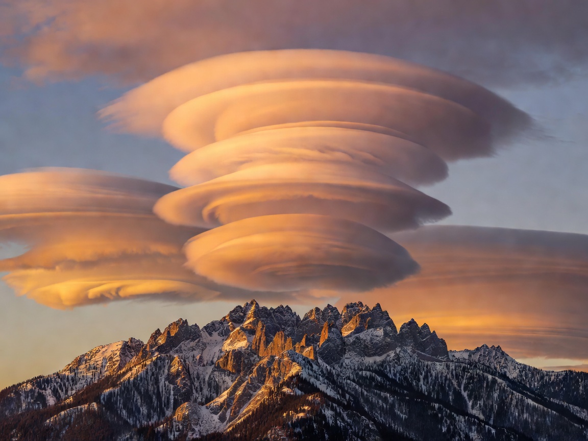
A still photograph of stacked, porcelain-smooth disks above Mount Rainier, Mount Fuji, or the Patagonian Andes creates the unmistakable impression of solid objects parked in calm air. Yet if an observer records a 60-second video of Altocumulus standing lenticularis, tiny edge wisps race leeward at gale speeds while the overall silhouette refuses to budge.
When stably stratified moist air crosses a mountain barrier, buoyancy restores displaced air parcels downward on the lee side, setting up stationary atmospheric gravity waves that propagate tens of kilometers downstream and high into the stratosphere. Each wave crest lifts air adiabatically below its dew point so droplets condense along the upwind edge; descending air in the trough warms adiabatically and evaporates those droplets along the downwind edge. Layered dry and moist strata sculpt multi-decked "stack of plates" formations.
Standing Lee-Wave Condensation Envelope
Mammatus, Asperitas, Cavum & Morning Glory
-
Cumulonimbus Mamma (Mammatus Pouches)
Pendant, udder-like lobes hang beneath thunderstorm anvils where ice-laden anvil air sinks into drier sub-cloud air. Sublimation of falling ice crystals cools pockets of air negatively buoyant relative to surroundings. Dramatic sunset grazing light exaggerates pouch relief; mammatus frequently appear on the decaying rear flank after peak storm intensity has already passed.
-
Cavum (Supercooled Glaciation Cascade)
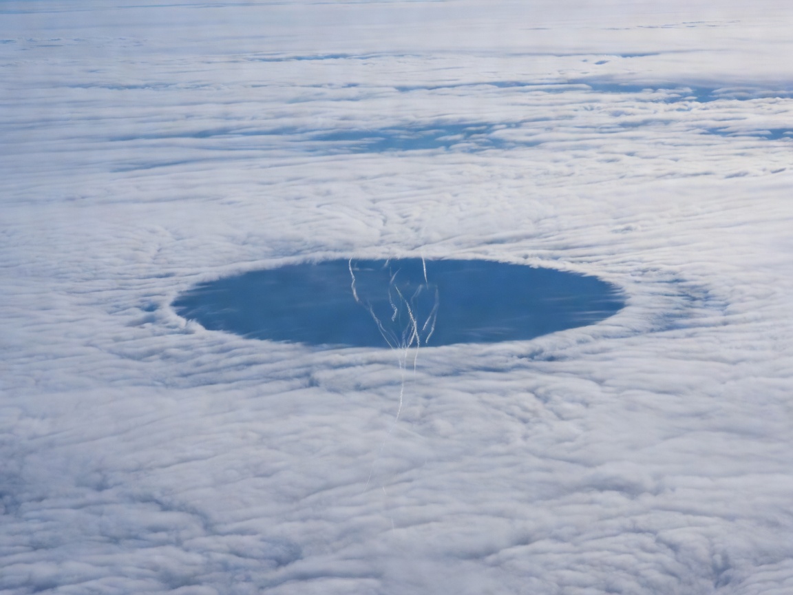
Thin altocumulus layers at −15 °C to −30 °C frequently consist of pure supercooled liquid droplets lacking ice nuclei. When a climbing or descending aircraft expands air behind propeller tips or wings, localized adiabatic cooling below −40 °C nucleates ice crystals instantaneously. Because saturation vapor pressure is lower over ice than water, surrounding droplets evaporate onto the growing crystals, carving an expanding circular or canal-shaped hole with snowy virga falling down the middle.
-
Volutus Roll Clouds (The Morning Glory)
Detached horizontal tubes stretching hundreds of kilometers—most reliably observed over Australia's Gulf of Carpentaria near Burketown each September–October—form along colliding sea-breeze solitary atmospheric bores rather than thunderstorm downdrafts.
WMO Classification & Field Reality Check
| Cloud Feature | WMO Classification | Typical Altitude | Primary Physical Mechanism | Common Photographic Misread |
|---|---|---|---|---|
| Lenticularis | Species (Ac, Cc, Sc) | 2,000 – 12,000 m | Orographic standing gravity waves | Mistaken for solid stationary structures or artificial craft |
| Mamma | Supplementary feature | 4,500 – 9,000 m (anvil) | Sublimation cooling & negatively buoyant pockets | Assumed to mean a tornado is imminent directly overhead |
| Asperitas | Supplementary feature (2017) | 1,200 – 3,500 m | Ducted atmospheric gravity waves & wind shear | Over-processed HDR photos make benign wave bases look apocalyptic |
| Arcus (Shelf vs. Volutus) | Supplementary / Species | 300 – 2,000 m | Cold-pool outflow lifting warm moist inflow | Horizontal scud motion mistaken for vertical tornadic rotation |