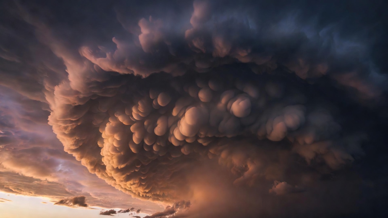
When the Atmosphere Does the Unexpected
A single frame can freeze an ice halo, a mountain wave cloud, or a lightning-threaded ash plume—yet a lens never records the full thermodynamic story. Learn how to separate visual drama from physical mechanism.
Read the Unusual SkyRead the Sky Before the Story
Viral weather photographs frequently arrive stripped of focal length, exposure duration, and solar elevation. Before naming a rare storm or optical event, field observers examine geometry, shadow direction, and phase state—liquid droplet, hexagonal ice crystal, or suspended silicate ash.
-
Angular Scale Over Apparent Size
Telephoto compression can make a routine 22-degree cirrus halo look immense above a skyline. Extending your hand at arm's length spans roughly 20 degrees from thumb to little finger—an instant field check that no lens can distort.
-
Exposure Time vs. Human Vision
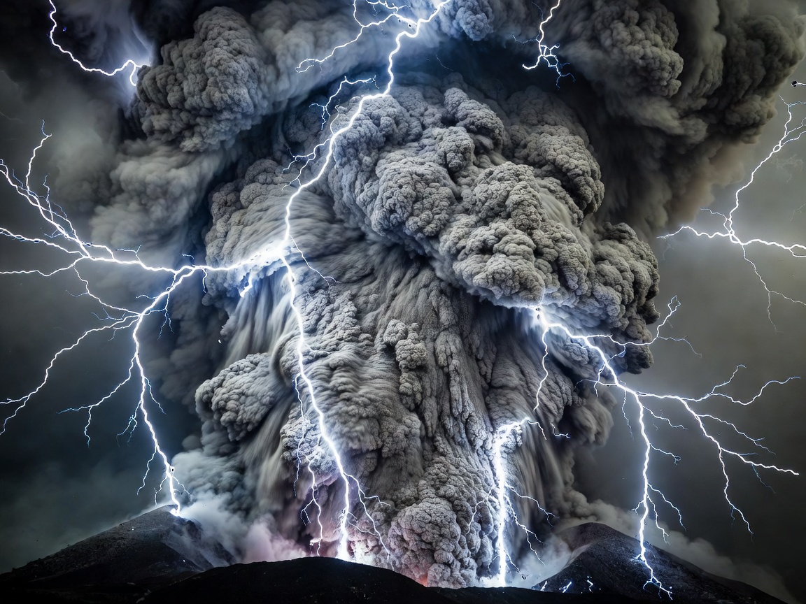
Ten-second shutter exposures stack dozens of discrete electrostatic discharges inside volcanic plumes into a continuous web, whereas the naked eye sees staccato flashes lasting milliseconds.
-
What Appearance Alone Cannot Prove
A lowering cloud base may look like a developing tornado, yet without persistent vertical rotation—verified by Doppler velocity couplets or multi-minute time-lapse—it is often a benign scud tag or shelf cloud outflow boundary.

Light That Tricks the Eye
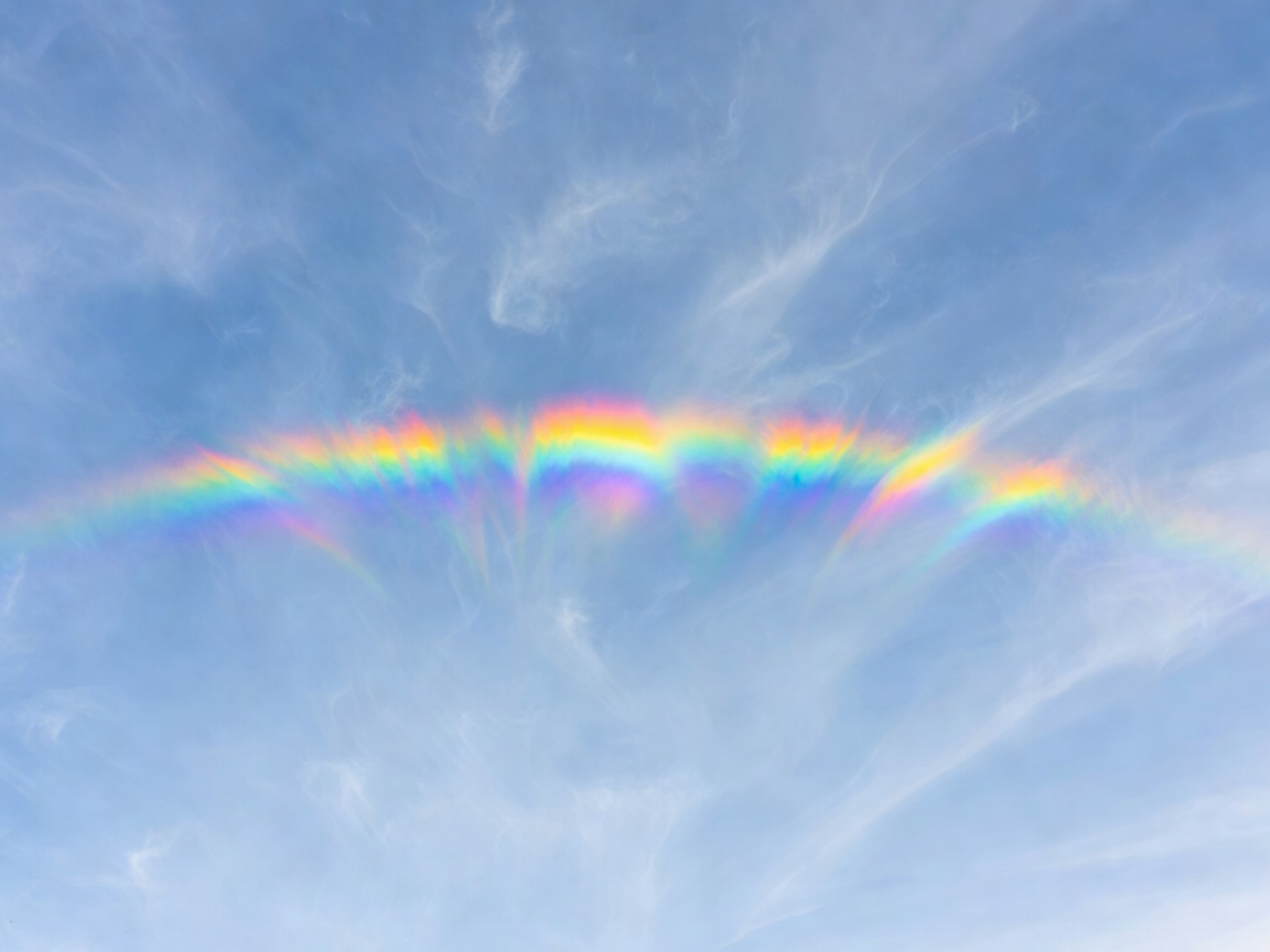
Optical phenomena are not objects located at a specific town or ridge; they are observer-specific ray paths formed by refraction, internal reflection, or diffraction between sunlight and airborne hydrometeors.
-
Parhelia (Sundogs) & 22° Halos
Minimum-deviation refraction through 60-degree ice prism faces concentrates light 22 degrees from the sun, placing red on the inner edge and pale green-violet outward.
-
Fata Morgana Superior Mirages
Strong thermal inversions over cold seas bend light rays downward in arcs, vertically stretching distant ships or coastlines into stacked, hovering battlements.
-
Brocken Spectres & Glories
Observed from mountain ridges with sun behind the viewer, backscattered diffraction in uniform mist droplets rings the observer's own shadow with pastel coronae.
Clouds with Unfamiliar Shapes
Clouds make invisible air motion visible—but only where relative humidity reaches saturation. Smooth, sculpted boundaries reveal laminar gravity waves or shear layers rather than chaotic thermal convection.
-
Altocumulus Lenticularis (Standing Mountain Waves)
Photographs show stationary lens stacks hovering leeward of peaks. Air rushes through the cloud at 20–40 m/s: moisture condenses at the cold wave crest and evaporates downslope, keeping the cloud fixed over terrain.
-
Fluctus (Kelvin–Helmholtz Shear Billows)
Breaking ocean-like crests appear for barely two minutes when a fast, warm upper air layer glides across a denser, slower layer below, rolling the interface into overturning vortices.
-
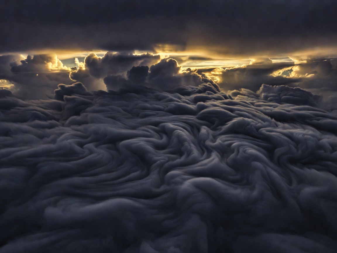
Asperitas & Cavum (Fallstreak Holes)
Formally recognized in the 2017 World Meteorological Organization Cloud Atlas update, undulating asperitas bases trace trapped atmospheric wave ducting, while circular cavum holes form when aircraft trigger rapid Bergeron glaciation in supercooled altocumulus.
Ice Built by a Storm
Gargantuan hailstones exceeding 10 to 20 centimeters in diameter do not bob up and down repeatedly like elevator cars; high-resolution radar studies show they grow during a single prolonged horizontal trajectory across a broad, rotating supercell updraft.
-
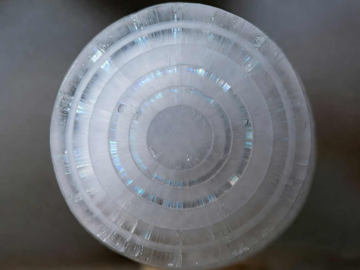
Wet vs. Dry Accretion Regimes
In dry growth, supercooled droplets freeze instantaneously on impact, trapping microscopic air bubbles (opaque rime). In wet growth, latent heat released by freezing keeps the surface slushy, forming dense clear ice and icicle-like lobes.
-
Documented Extremes: Vivian & Villa Carlos Paz
On 23 July 2010 in Vivian, South Dakota, a verified stone measured 20.3 cm (8.0 in) across and weighed 0.88 kg. Photogrammetry from Villa Carlos Paz, Argentina (2018) documented irregular stones estimated up to 23.7 cm—establishing the "gargantuan hail" class (≥15 cm).
Where Heat Creates a Vortex
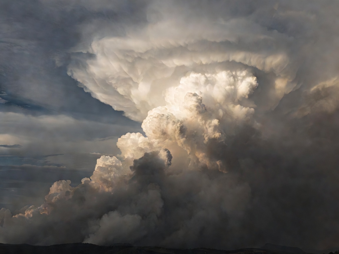
Photographs of spinning flame columns are routinely grouped under the casual phrase "fire tornado," yet atmospheric scientists draw a strict physical boundary between localized surface fire whirls and deep, cloud-coupled fire-generated tornadoes.
-
Fire Whirls (Boundary-Layer Scale)
Typically 1 to 30 meters wide and lasting seconds to a few minutes, fire whirls tilt and stretch ambient ground-level vorticity through intense buoyant updrafts without connecting to a deep rotating cloud base aloft.
-
Pyrotornadoes (Pyrocumulonimbus Coupled)
During the 2003 Canberra bushfires and the July 2018 Carr Fire near Redding, California, extreme wildfire plumes built towering pyrocumulonimbus clouds whose rotating updrafts tightened into true tornado-strength vortices—with Carr Fire radar and damage surveys confirming winds above 64 m/s (EF3 equivalent).
Lightning Beyond the Thundercloud
Violent explosive eruptions generate intense electrical storms even in dry atmospheres devoid of meteorological weather fronts, driven by two distinct charging altitudes inside the ash column.
-
Near-Vent Fractoemission & Tribocharging
Within hundreds of meters of the crater (documented at Sakurajima and Eyjafjallajökull), pulverizing magma fragments and colliding silicate grains exchange electrons by friction, sparking short, rapid vent discharges.
-
Stratospheric Ice-Ash Collisions
When magmatic steam ascends past the −20 °C isotherm—most dramatically during the January 2022 Hunga Tonga–Hunga Ha'apai eruption, which produced nearly 200,000 flashes in a single hour—ice-coated ash behaves like a supercharged mesoscale thundercloud.
Separate Spectacle from Explanation
Quick answers to common misconceptions encountered when remarkable sky photographs circulate online.
Can green skies guarantee an approaching tornado or giant hail?
No. Greenish storm light occurs when late-afternoon reddened sunlight is scattered and filtered through a deep column of high liquid-water/ice content. While deep thunderstorm cores capable of green tinting often produce severe hail or wind, the color itself measures optical path thickness, not rotation.
Are "heat lightning" flashes silent discharges caused by hot summer air?
Every lightning channel superheats air and creates thunder. So-called heat lightning is ordinary cloud-to-ground or intracloud lightning from a storm 25 to 100+ km away whose sound waves refract upward above the observer due to warm surface air beneath cooler air aloft.
How can I tell a fake AI-generated storm photo from a real cloud formation?
Check thermodynamic consistency: real supercells exhibit crisp inflow bases separated from fibrous glaciated anvils above, consistent shadow geometry from a single sun angle, and natural atmospheric haze over distance rather than uniform high-contrast curls from ground to zenith.
Continue Your Field Study
Browse full answers on optical angles, radar signatures, and camera settings, or submit a sky photograph context note for meteorological breakdown.